Dalgety Bay Community Woodlands Group

 |  |  |  |  |  |  |
|---|---|---|---|---|---|---|
 |  |
History of the Woodlands
Given that the areas presently occupied by these woodlands appear on a map of 1811 showing the layout of the "Parks of Donibristle" prepared for the Earl of Moray, it can safely be said that these woodlands have exiated for some considerable period of time.
The town of Dalgety Bay is built on land that had been in the hands of the Earls of Moray for some 700 years. They rebuilt Donibristle House house around 1700, and again after a fire in 1798 and although the main house burnt down in 1858, the front wings, that had been servants quarters and offices, and to the east, the family chapel, survive. The sighting of the house made good use of the wonderful views across the Forth including Inchcolm Island and it's 13th century Abbey. The estate and gardens were redesigned in 1781 by Thomas White Snr. and this included walling the woodlands which has helped to protect what we see today.
The woodlands themselves occupy steep slopes and rocky outcrops that would in any case have been unsuitable for agriculture and their use in the 18th and 19th Centuries would have been as shelter belts, harvesting of some timber, and reserves for game birds and deer.
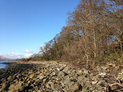
Of particular interest is Bathing House Wood, and the OS map of 1856 shows the woodland with a "summer house" marked, as well as a footpath along the shore to the steps up to Downing Point. From the name given to the woodland by the 1897 map, it can only be presumed that the Victorian enthusiasm for the perceived "health benefits" of sea bathing had lead to the bay in front of the woods being furnished with a bathing house to allow the Earls of Moray and their guests to indulge in this activity.
The 1856 OS map below is shown with permission of the National Library of Scotland
